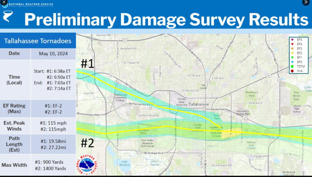
On Sunday, the National Weather Service (NWS) confirmed three tornados hit southern Leon County on Friday morning. The NWS released detailed information related to the three tornados.
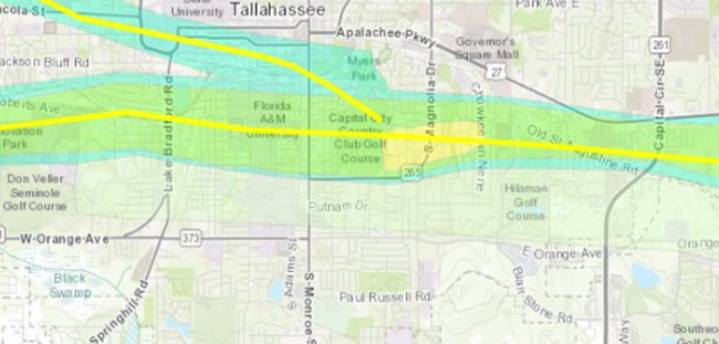
Below is an image showing the full-scale of the two tornadoes. Tornado #1 shows up in the image at the intersection of West Tennessee Street and Capital Circle. The tornado started at 6:38 a.m. and dissipated around the Capital City Country Club at 7:03 a.m.
Tornado #1 was rated an EF-2, reached peak winds of 115 mph, had a path length of 19.6 miles, and a width of 900 yards.
Tornado #2 shows up on the image south of Blountstown Highway. The tornado started at 6:50 a.m. and dissipated at 7:14 a.m. The path shows the tornado traveling east directly through the Capital City Country Club.
Tornado #2 was rated an EF-2, reached peak winds of 115 mph, had a path length of 27.2 miles, and a width of 1,400 yards.
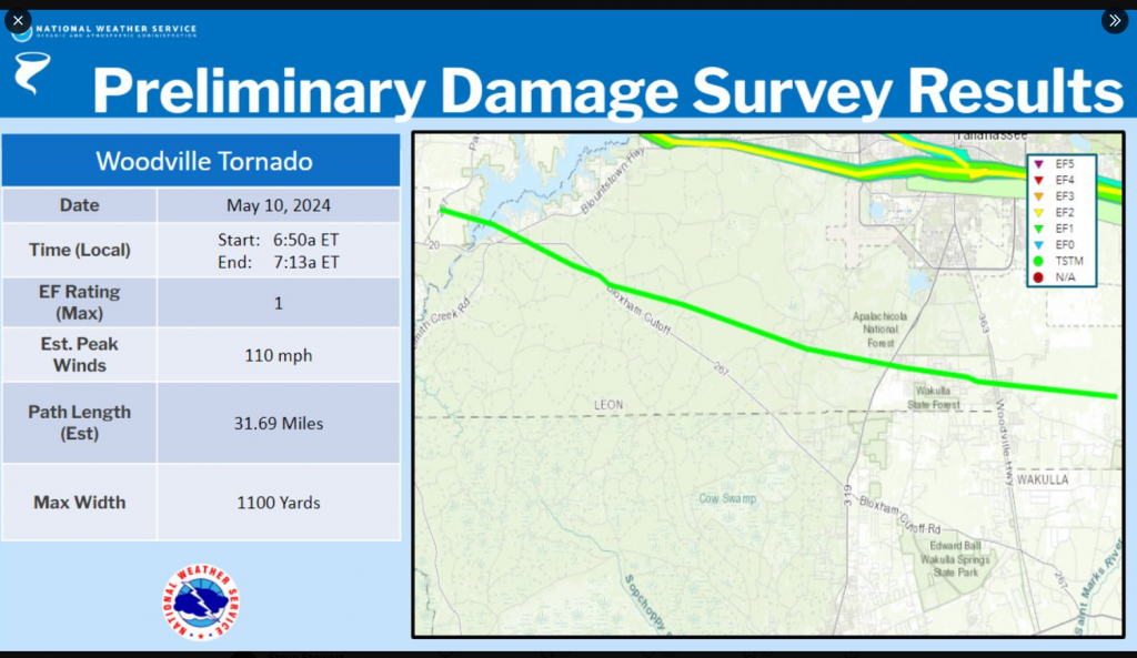
A third tornado occurred at the same time as the other two. The tornado stayed south of the Tallahassee metro impacting areas near and within Woodville. The tornado was rated an EF-1 with peak winds of 110 mph, a path length of 31.7 miles and width of 1,100 yards.


I am praying for your Area. I live in NC and have been watching the storm for our State! I’m so sorry to hear about three Tornadoes! I pray you have plenty of assistance. God Bless
@ A Skeptic = I live just before Louvinia by the Sonoco Station.
My kids live out the Parkway, just past Louvinia. One of the tornadoes went right over their house and tore up a lot of stuff near their neighborhood.
I think Tallahassee's really fortunate that so few people were physically hurt by these storms!!!
Considering all the Utility Poles that were snapped in half, The Linemen are doing an awesome job getting the power back on. THANK YOU LINEMEN (and WOMEN).